Alternative Bike Route
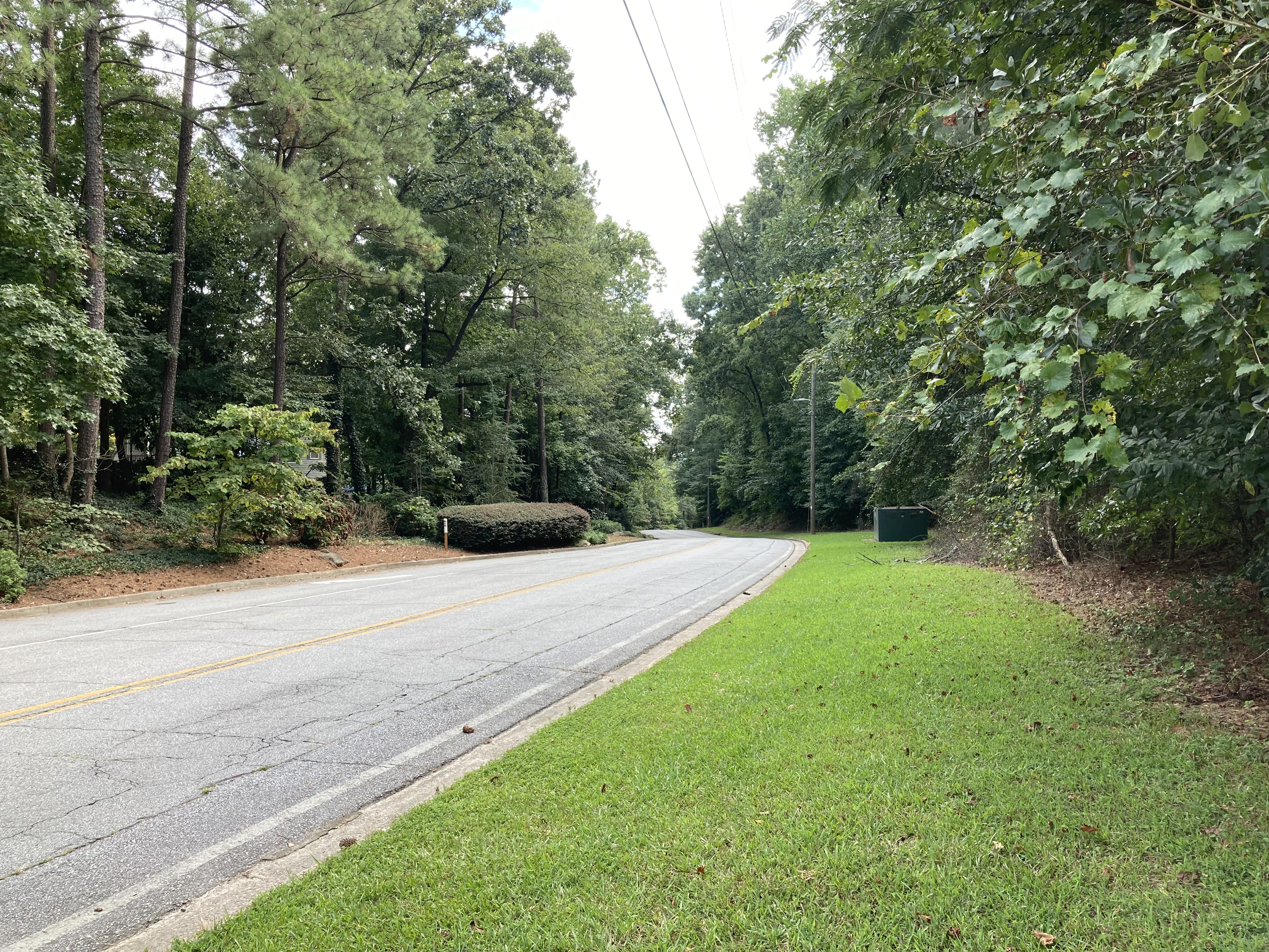
Flowers Road
PATH says they want a bikeable/walkable east-west connection between Henderson Mill Road and Mercer in order to connect Tucker to the North Peachtree Creek area. However, they are ignoring an already existing route - Flowers Road.
Flowers Road is a pretty road, quiet and relatively wide, with ample room to add a safe sidepath style bike path. There is a sidewalk on part of it already. It runs parallel to the Henderson Mill Creek floodplain, and is on the “commercial side” of PATH’s proposed route. Flowers Road can provide the same east-west biking accessibility to North Peachtree Creek/Mercer as our creek wilderness. So why isn’t it being considered? Why isn’t it even being mentioned as an option?
Conservation Approach to the Floodplain
PATH proponents say they want to experience nature, but their elevated concrete path does not allow its users to do so. Their proposal is effectively a transportation route that happens to run through the floodplain but which keeps its users isolated from it. We think it would be much better to route bikes via a sidepath style route along Flowers Road, and develop an ecologically sensitive nature trail and preserve in the floodplain.
Sidepath Style Bike Path on Flowers
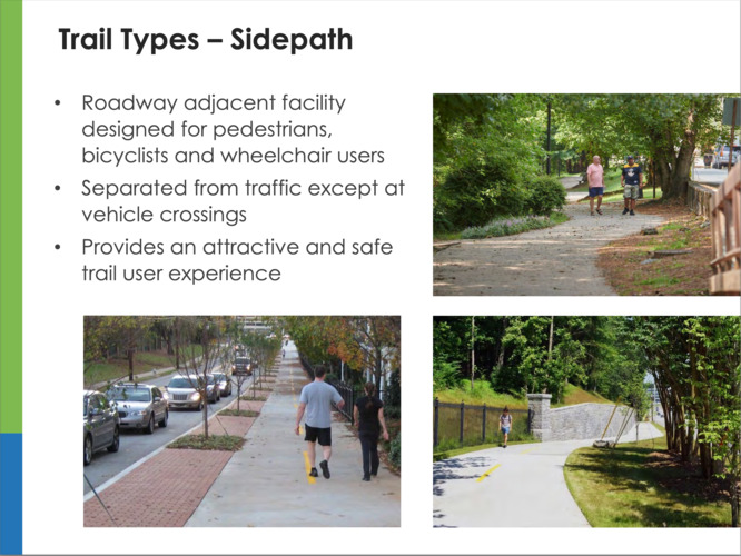
Sidepaths
The 2019 Tucker Master Trail Plan shows plans to connect to this area via a “sidepath” route along Midvale and Henderson Mill Roads. The Tucker plan is for a bike path isolated from traffic with a buffer, but built along the existing street - a “sidepath” in PATH’s terminology. Continuing the sidepath routing along Flowers is a continuation of the approach that PATH has already endorsed for Tucker. Why is Flowers Road not good enough, but Midvale is?
Tucker’s sidepath route could easily be extended briefly up to Mercer University Dr and then along Flowers Road. At the 9/16 Peachtree Creek Greenway walk behind the District Office building, a short cut through of about 30 feet connected the parking lot to the proposed Greenway trail location. It is completely possible to route a quiet sidepath style bike trail along Flowers Road to terminate at such a cut through to the Greenway. This would have no impact on the Henderson Mill Creek ecosystem and would surely be less expensive.
It would alleviate concerns about security on a more isolated path through the creek area - something unlikely to be routinely patrolled by the police. A sidepath along a public road would naturally have more eyes on it and be patrolled as a side effect of existing measures.
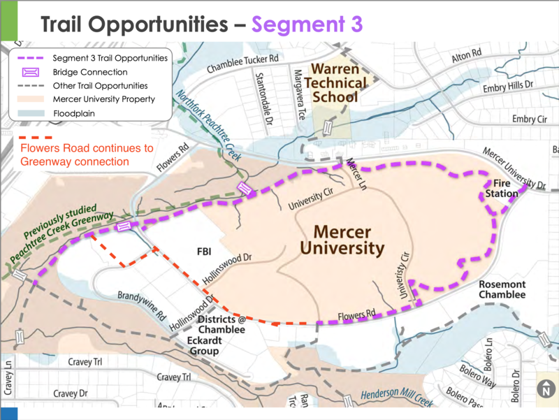
In fact, the 9/27 PATH presentation (slide 48) shows something much like this, but fails to “connect the dots” to connect the Flowers Rd trail to the greenway. We’ve annotated that slide 48 map with a short extension that would allow it to connect to the Greenway at the District Office.
Flowers Road to PCG Connection
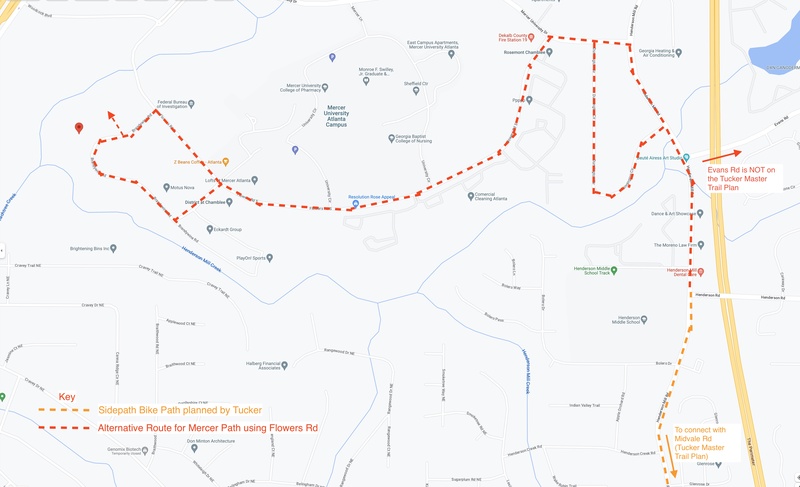
Flowers Road To Tucker
When challenged with this proposal at the public meeting, the PATH rep said it would be impossible since it would need to contend with a bridge at the end of Flowers Rd. (and due to the format of the presentation, there was no opportunity to challenge that statement!) The path we are suggesting above never needs to go as far as that bridge.
The Flowers Road To Tucker image shows a full route from the North Fork PCG to the Tucker Trail system. The sidepath could run all the way up Henderson Mill Rd to Mercer University Dr and then to Flowers, or could detour through Dunnington Circle as a “calm street” (also something that PATH promotes as a viable way to create safe bike paths.) There is no need to pour concrete in the Henderson Mill Creek (HMC) floodplain!
Why is this not an option?
When talking with PATH representatives at the 8/24 open house, we were told directly that Flowers Road wasn’t an option – that building in the floodplain was already a done deal. And, sure enough, despite community opposition and a viable alternative, PATH’s 9/27 “initial findings” presented the HMC floodplain as a required part of the route plan.
What kind of a “study” has already pre-determined the outcome? The truth is that PATH has had the HMC floodplain on their radar since 1999, and included it in their 2021 North Fork Peachtree Greenway “final study” document.
PATH is not doing a study regarding the HMC floodplain. PATH is marketing an HMC floodplain bike route that they have been planning for years.
What is wrong with biking along a pretty, quiet road to get to Mercer?
Why do they have to invade the floodplain when an existing, already developed route could be used?
Why would someone prefer to clear a large swathe of floodplain and pour concrete there instead of using an existing developed route that would leave the wilderness alone?! How can this plan possibly be considered a good thing to do?
Tell them that we don’t want concrete in the floodplain! We don’t want the Henderson Mill Creek wilderness developed! We don’t want any of the habitat invaded on either side of the creek!