Peachtree Creek Greenway (PCG)
The first section built of the North Fork Peachtree Creek Greenway (PCG) is the Model Mile. Completed in 2019, it is located behind REI off of the I-85 access road between Druid Hills and Briarwood roads. PATH and the Peachtree Creek Greenway Foundation (PCGF) are quite proud of their Model Mile. During the initial Mercer Trail Study presentation, their representatives told us to look at the Model Mile as the most recent example of what they want to achieve. The Model Mile is what they want to do with the entire area of the North Fork and its tributaries such as Henderson Mill Creek.
So we looked. And we saw just how invasive and destructive the PCG plans are. They are not looking to restore, repair or even enhance the remaining natural area along the creekbank. They are looking to replace it with an urbanized city park environment.
They thought we would be convinced, but they couldn’t have been more wrong.
Peachtree Creek Greenway is Not the Green Way
PATH and the PCGF like to promote their “greenways” as ecological and environmental, but they are anything but green. The Model Mile clearly shows how non-environmental this type of construction actually is.
The floodplain lining the creek system is one of the last remaining riparian natural habitats left in the city. It was cleared it to make way for an urbanized, manicured city park. Now, there is nothing wrong with parks. We like parks. In the proper places. This is not the right place, and neither is Henderson Mill Creek.
This is what was done:
- A previously dense forest canopy was cleared to make way for 3 acres of concrete, running in a 14-ft wide swathe well within state and county riparian buffer setbacks.
- Previous dense underbrush, highly absorbent and home to wildlife, was completely cleared and replaced mostly by mown lawn grass.
- Despite multiple “Wildlife Habitat” signs, there is no natural habitat remaining.
- GA Department of Natural Resources (GA DNR) stated that it preferred “multi-trophic native riparian vegetation” be used for cleared areas, yet mown lawn grass was used.
- GA DNR requested a fauna survey prior to development, which was not done.
- Brookhaven has a 50’ riparian buffer zone (on top of the state 25’ zone), but the city did not even require that a waiver request be submitted before it granted permission to breach it.
- The Corblu waiver request documentation clearly states that regulations prohibit tree removal in a floodzone, yet somebody decided that PATH could remove a multitude of trees with a replacement density of only 120" dbh per acre. This is certainly insufficient to replace a forest, and in fact is less tree cover than most of us have in our yards!
Bridging the Water
The PCG bridge is perhaps the clearest indication of what PATH/PCGF are striving for - an urban park experience. It is mammoth. Very wide, heavy concrete and glaring silver metal fencing. It looks like it belongs in the center of a city. There is absolutely no attempt to blend in with the natural environment. Rather, it seems to have been designed to be as obtrusive as possible.
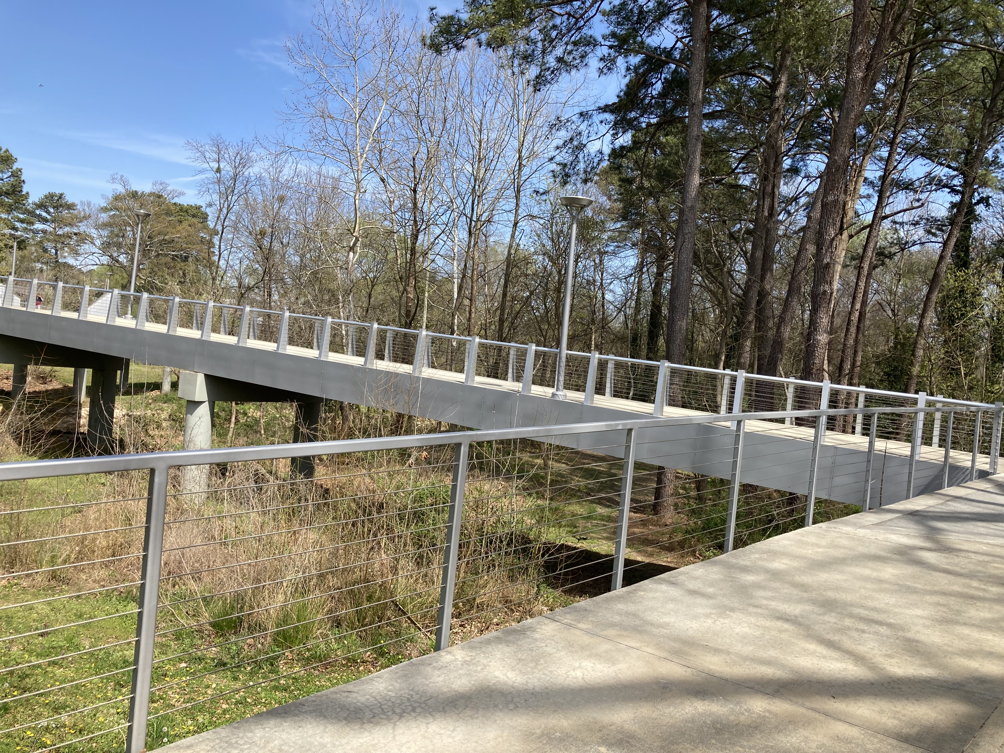 PCG: Concrete and Steel Urban Bridge Design |
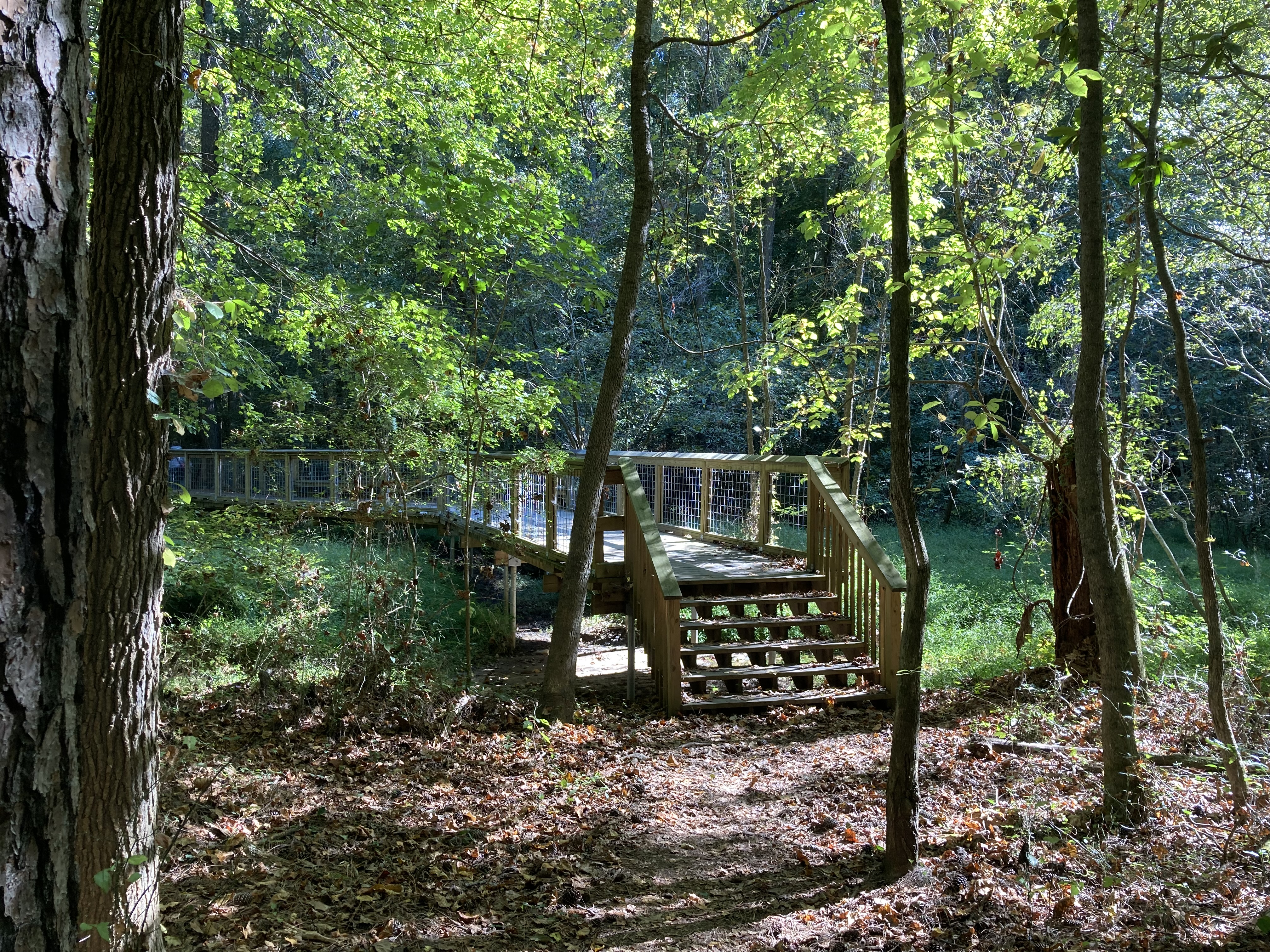 Natural Bridge Design (John Homestead) |
Contrast this with the typical natural approach for bridging structures, as done in Tucker’s nearby John Homestead park. If bridging is unavoidable, those who are providing a natural experience choose a design that blends into the surroundings.
In the HMC presentations, PATH displayed their “artist conception” of the raised bike road, made of concrete and steel. The actual Model Mile bridge shows you what these designs look like in reality. We do not want structures like this built in the floodplain, particularly under claims of providing a “nature experience.”
Nature Experience
PATH and the PCGF continually refer to these 14’ wide concrete bike routes as a means for people to experience “nature.” The problem is that the habitat alongside Peachtree Creek is narrow. Once PATH has done its construction, there simply isn’t any natural habitat remaining. Most of the trees are cleared, erasing the forest canopy, and the natural vegetation is replaced by PCG’s park-like lawn grass.
 PCG: Minimal Nature Remains |
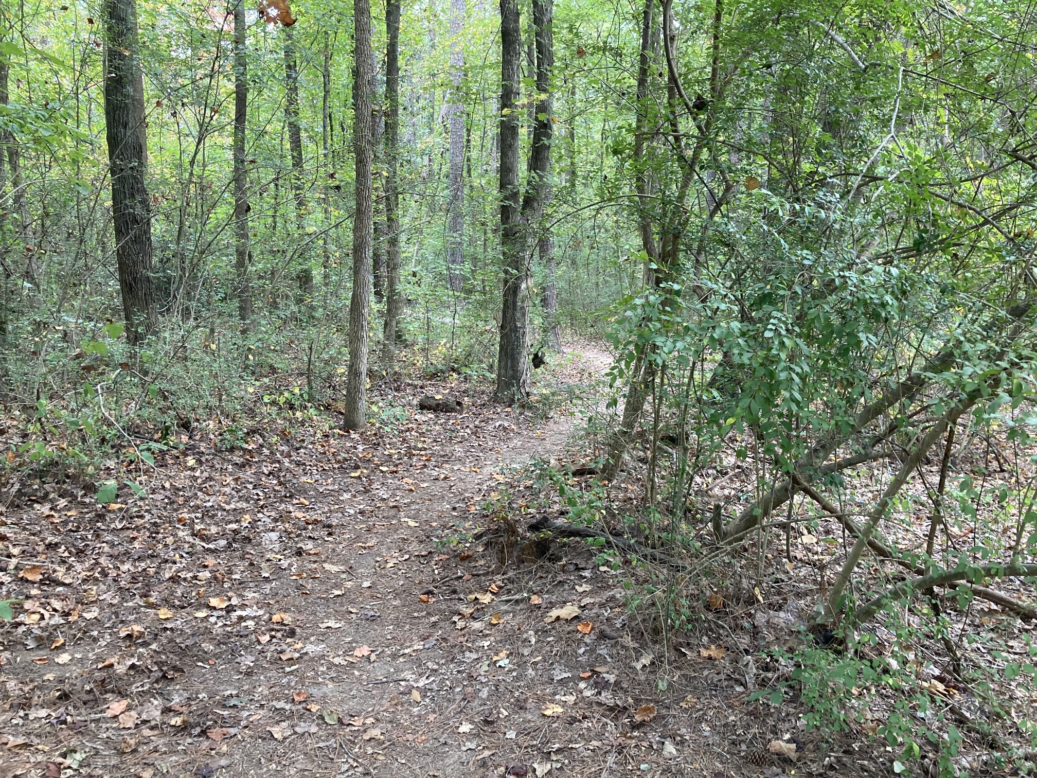
 Nature Trail (John Homestead) |
John Homestead nature preserve is an excellent example of a true trail system that preserves the natural experience. It is non-invasive, non-damaging, and leaves the habitat intact.
Trail vs Bike Road
We have insisted on calling the PCG construction what it is - a bike road. The intent is to create an alternate transportation route for bicycles, and it shows. Nobody needs 14’ wide concrete for pedestrian traffic. You only need it for routes intended for high-volume/high-speed bike access.
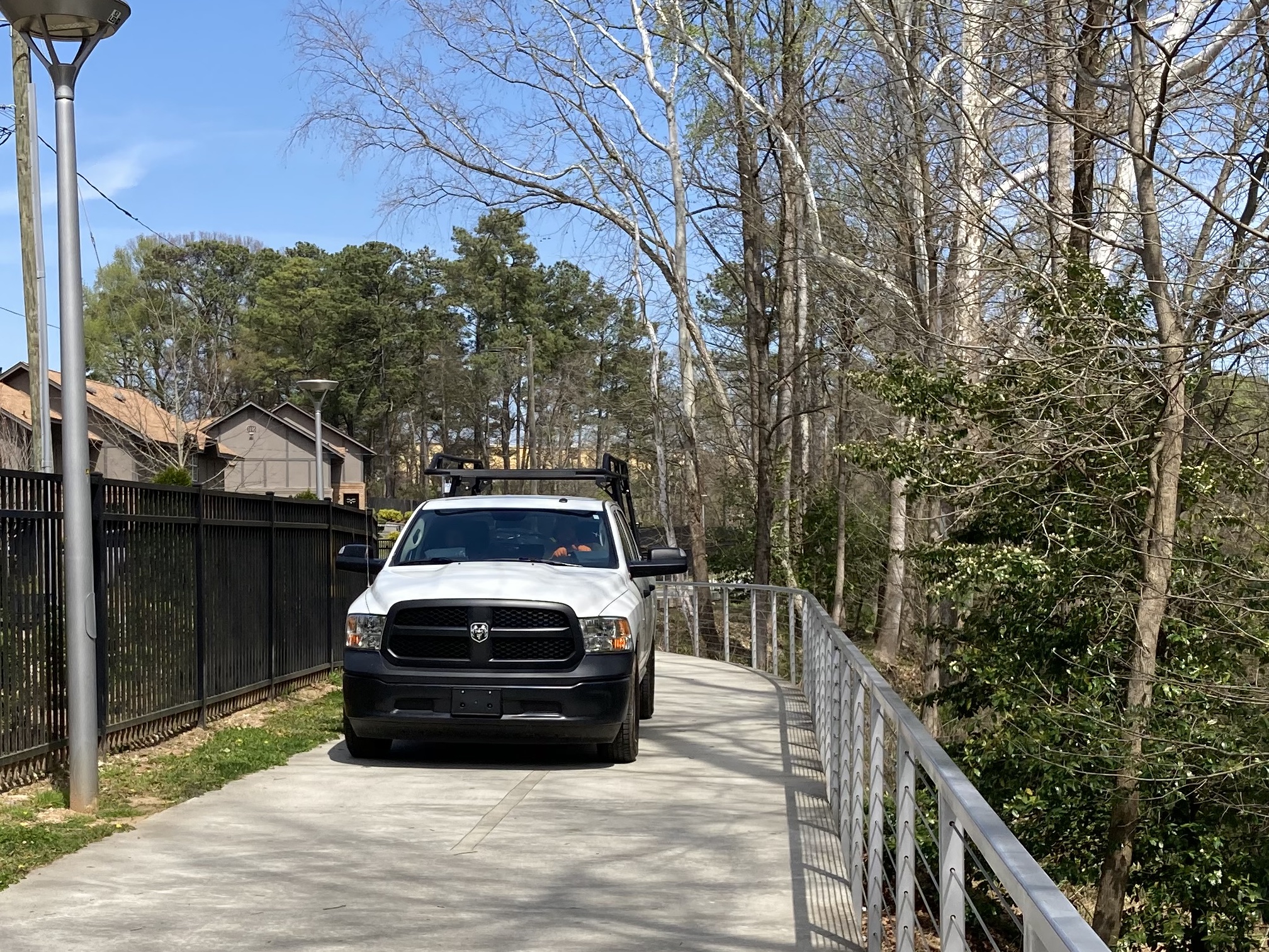 PCG: A Road |
 Nature Trail (Cecil B Day) |
And as it turns out, these bike roads are used for more than bicycles. They are also used for… trucks. You could never drive a truck on a real trail such as Mercer’s own Cecil B Day trail. A true trail is not, and cannot be, used for vehicles.
In fact, PATH takes advantage of the “road status” when it’s convenient. As part of the DNR waiver for this section, DNR wrote: “project is considered road construction and is exempt from the Erosion and Sedimentation Act as per 12-7-17(9).”
Don’t tell us that the PCG is not a road.
Floodplain
There is a good reason why the DNR doesn’t want concrete within the 25’ buffer.
 PCG: Flooding on the Bank |
 Natural Creek Bank (NFPC) |
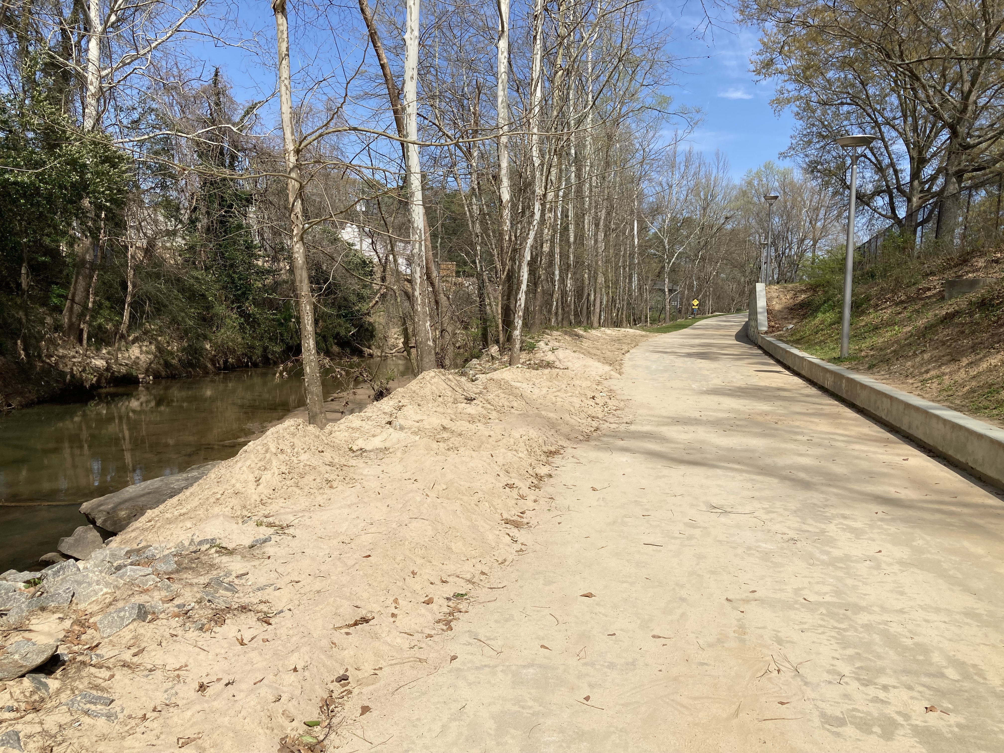
The left photo shows the PCG concrete covered in mounds of silt left from heavy rains when the creek rose and flooded the bike road, leaving the sand behind. The impervious concrete causes more creek overflow during rains, and leaves nowhere for the resultant silt to go. And this is just what happens on the PCG - nobody is discussing what happens upstream or downstream after acres of floodplain concrete are laid.
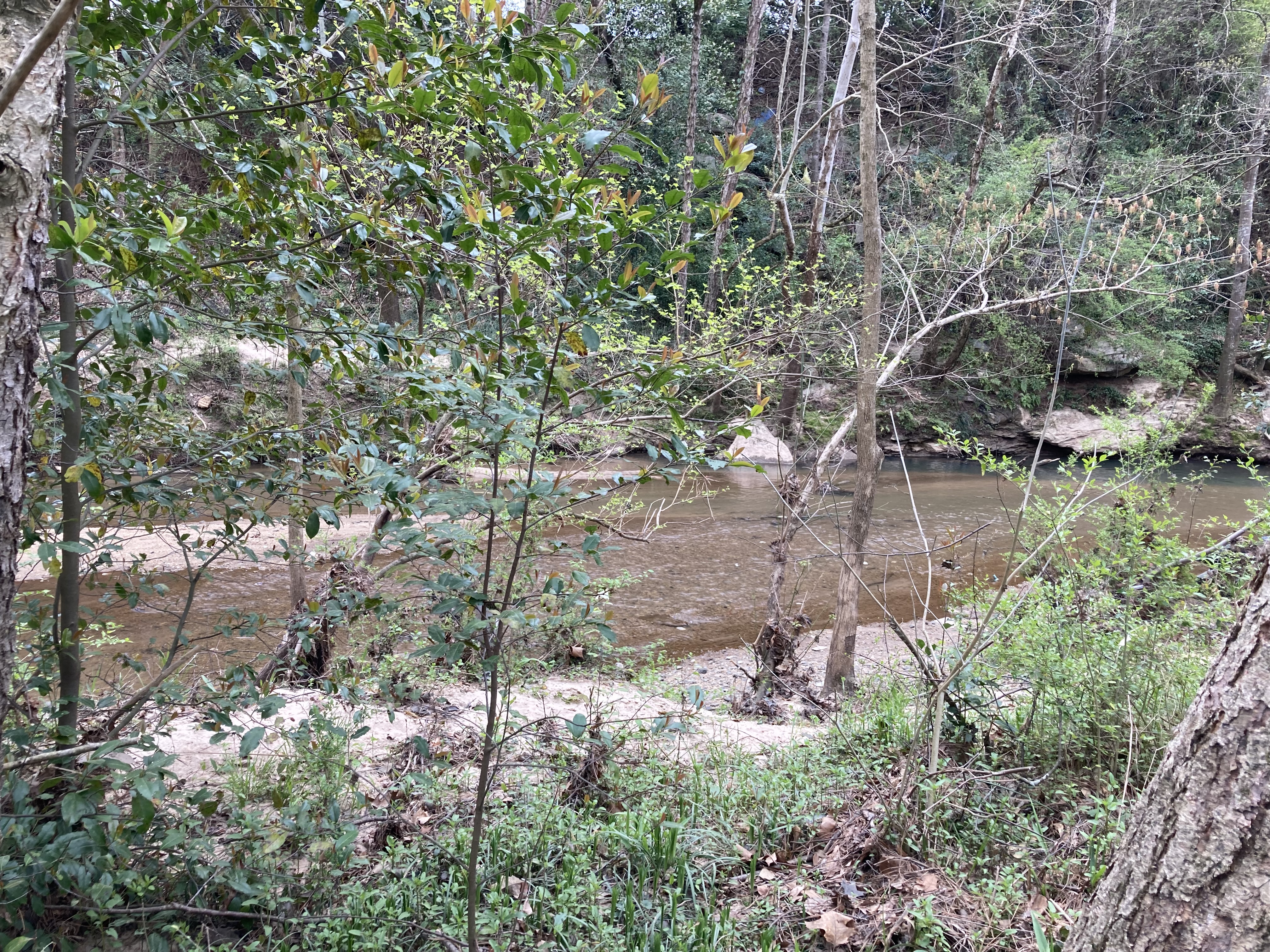
The photo on the right shows a currently undisturbed section of the creek just north of the PCG. Periodic flooding naturally silts this low-lying area, but it drains leaving just a small sandy beach behind. Imagine what will happen when the upcoming PCG concrete is laid in an area such as this, level with the water.
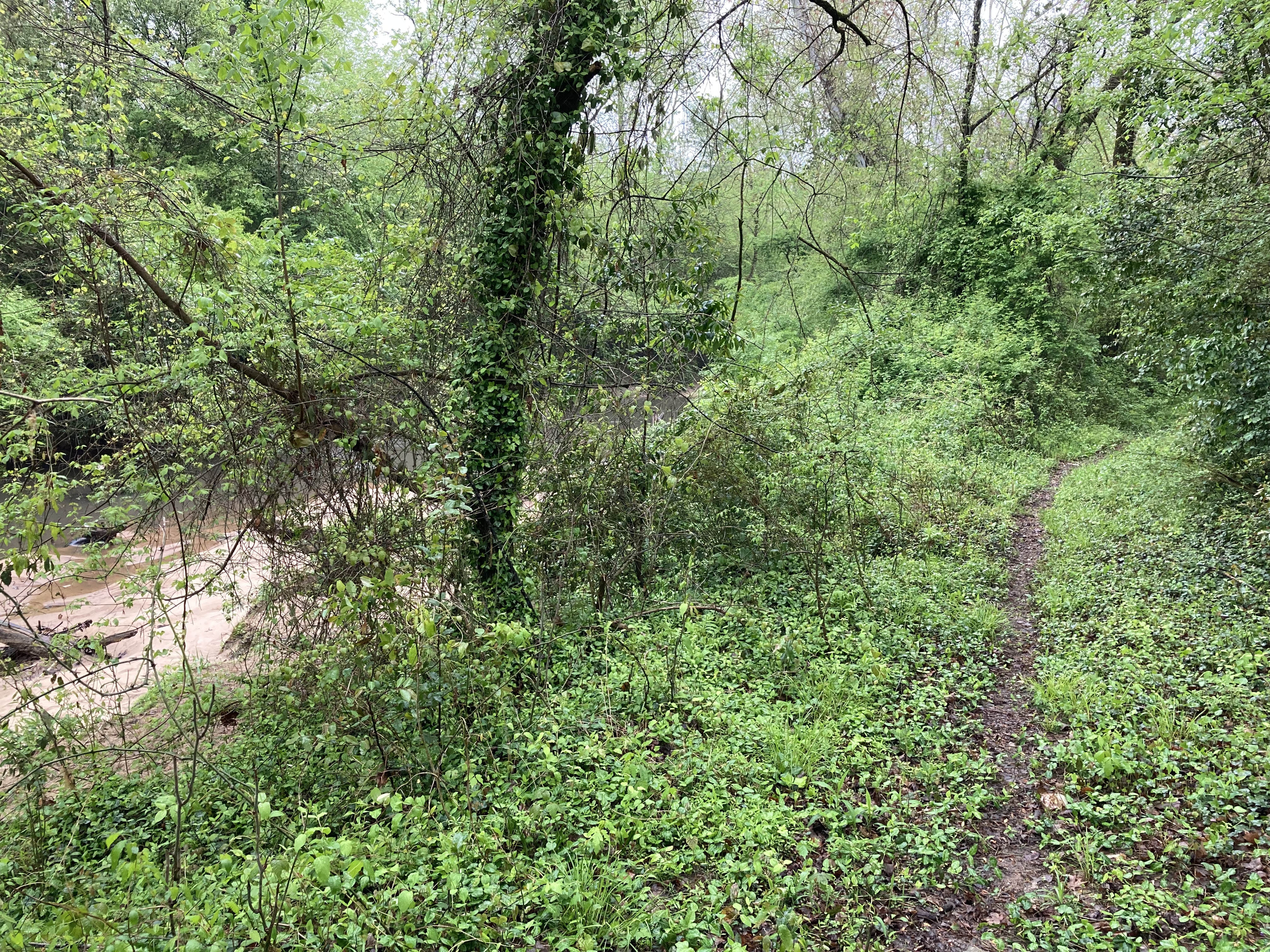
Natural Riparian Vegetation
PATH’s “linear park” design includes large cleared areas with regular lawn grass in replacement of natural creek bank vegetation. Lawn grass is actually very non-absorbant relative to normal brush/plant life, and will compound the increased flooding issues that are going to arise from all the concrete. In addition, this lawn is very difficult to maintain, as you can see in the left photo showing that the grass is already overtaken with weeds.
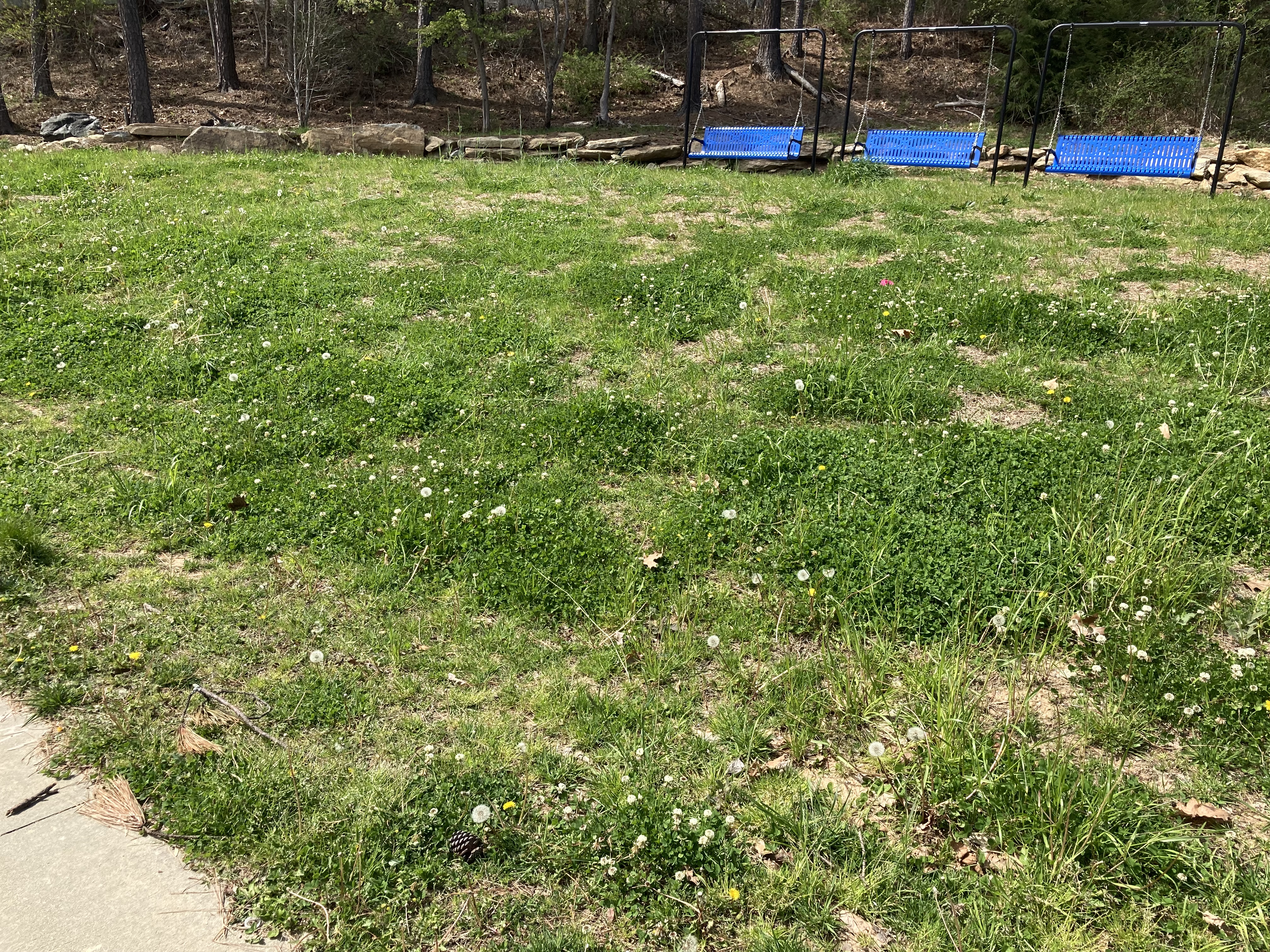 PCG: Mown Lawn (with Weeds) |
 Natural Creek Bank (NFPC) Vegetation |
As in the prior section, the photo on the right shows a currently undisturbed section of the creek just north of the PCG. This was taken in March, before the spring greenery. Yet you can still see that it is dense, absorbant and tall enough to provide shelter, nesting, and food for the floodplain wildlife. Clearing the underbrush and replacing it with lawn grass is just as destructive to the floodplain habitat as clearing the trees to replace them with concrete.
Concrete Retaining Walls
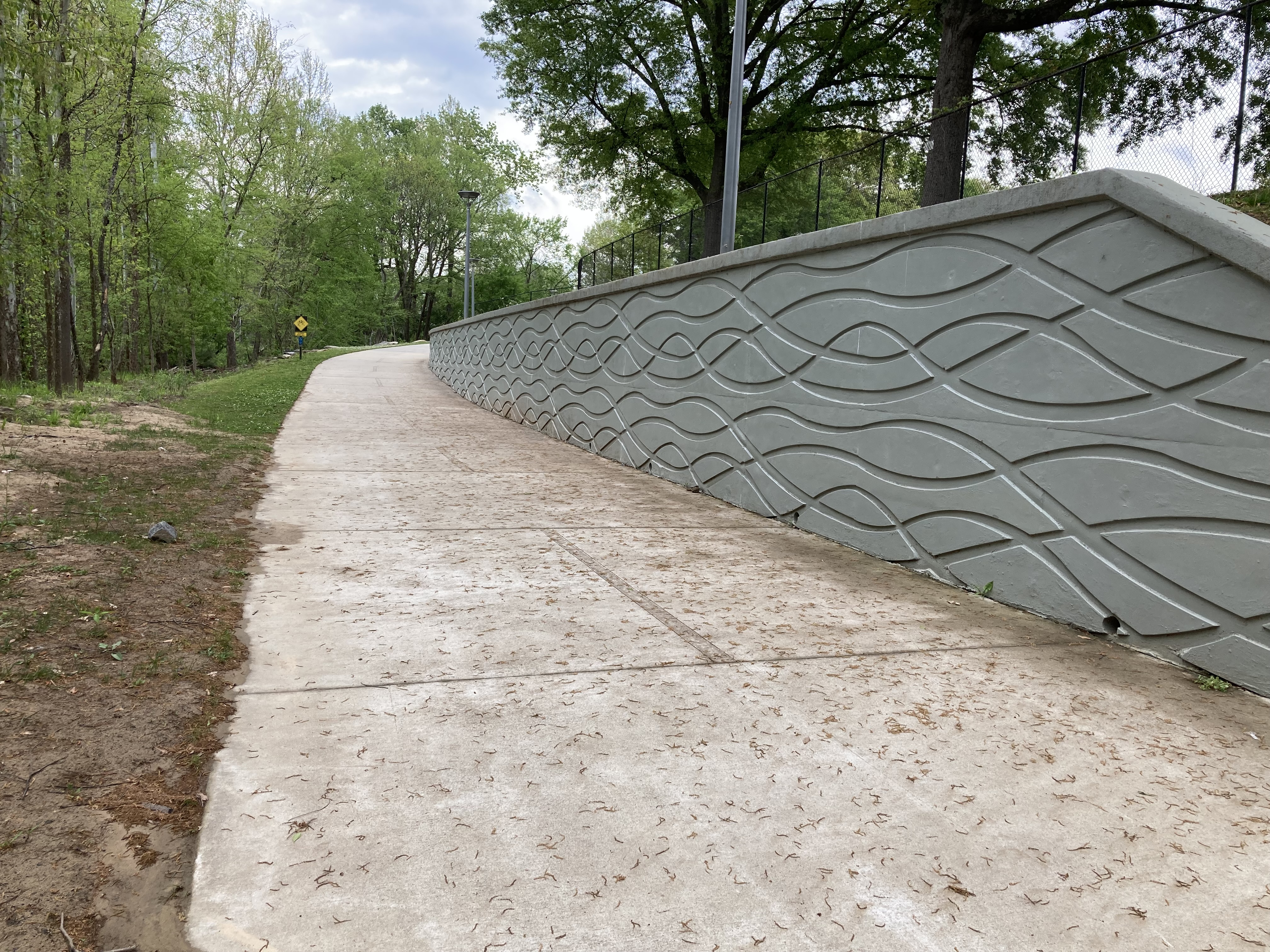 Concrete Urban-Style Retaining Walls |
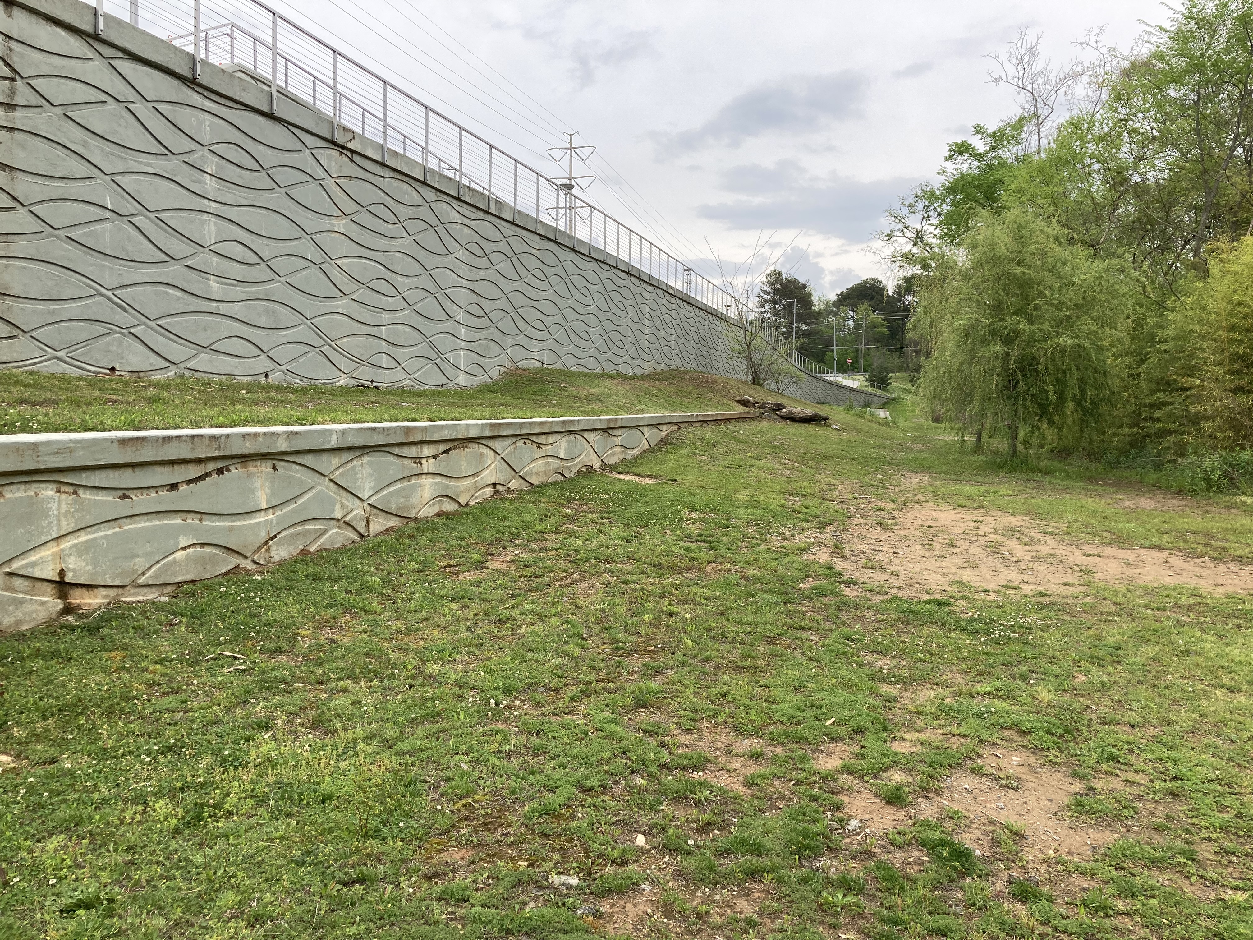 More Concrete Retaining Walls |
Thick concrete retaining walls are installed in multiple areas of the Model Mile, indicating that not only was the natural vegetation cleared but that a lot of the soil was also removed in an attempt to level this hilly terrain. Trees were removed, brush was cleared, and the ground was leveled. Rather than preserving, restoring and repairing the creekbank floodzone, PATH remodeled it to suit their tastes.
As with the bridge, there is not even a vague attempt to make the retaining walls blend with what is left of the natural surroundings. They are simply stamped concrete, as is common in a city center. The PATH/PCGF approach is to make the Peachtree Creek look like downtown, rather than let the Peachtree Creek be preserved and appreciated as one of the last remaining natural riparian areas inside 285.
Narrow Habitat Stretches
 Planned PCG Route: No Room |
In most areas the remaining forested creekbank along PC is very narrow and the sewer easements that PATH wants to use are very close to the bank. As little as 20’ is all that remains in some sections. Once PATH clears out trees and underbrush to make room for the 14’ concrete and surrounding mown grass, there will be practically nothing left of the original natural habitat.
There is no room for this sort of development without obliterating the creekbank habitat. Which is something that PATH/PCGF don’t seem to much care about, based on the Model Mile.
Peachtree Creek Greenway is Extremely Expensive
Not only is it not green, the PCG construction is extraordinarily expensive. The Model Mile cost Brookhaven $16 million. The next mile-long segment is estimated at $27 million, and will likely over-run significantly. Dekalb is going to pony up $800 thousand just for “design” of the 3rd segment, with no mention (yet) of the expected construction cost which we believe will likely be even higher than Brookhaven’s 2nd segment.
This is a lot of money, and what do we get? A mostly stripped riparian habitat, acres of concrete in an active floodplain, lawn grass instead of native riparian vegetation, a “trail” that trucks drive on, concrete retaining walls on this very hilly terrain, and lumbering concrete bridges with silver steel railings.
This kind of money could have actually repaired and restored the creekside terrain properly, with room left over for an non-invasive, soft, real trail. An opportunity to allow the community to enjoy the outdoors while learning about the riparian ecology, as well as allowing the wildlife to remain living along the creek path.
Which is a better use of taxpayer dollars? Which is the true green way?
NO to PCG/PATH Type Construction
The PCG Model Mile is PATH’s and the Peachtree Creek Greenway Foundation’s pride and joy. It is what they wanted to build, and it’s what they intend to build throughout the rest of the North Fork Peachtree Creek bike road network, and it is what will happen to the Henderson Mill Creek floodplain if this goes forward.
We say No to PATH. No to Dekalb. And No to the bike road. We do not want this concrete bike route built through the Henderson Mill Creek floodplain.