SAVE THE HENDERSON MILL CREEK FLOODPLAIN WILDERNESS!
Stop the Henderson Mill-to-Mercer PATH Bike Road through the Floodplain
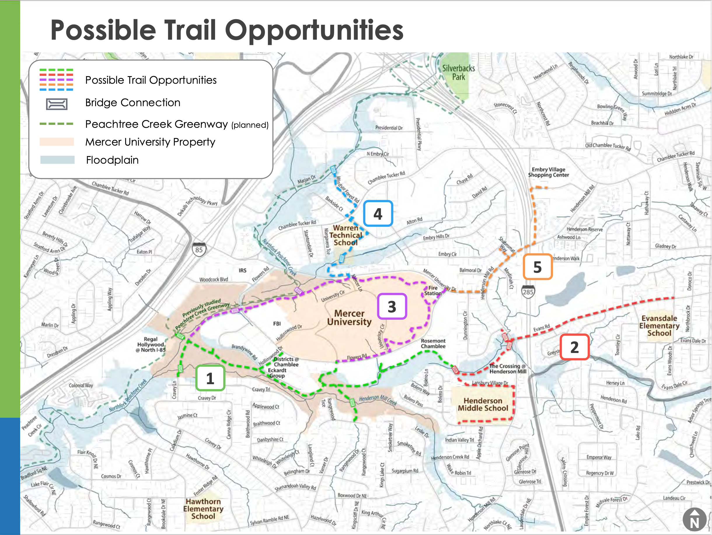
News! (10/2/2024) Dekalb has officially pulled back from the Eastern part of the floodplain and removed neighborhood egresses! BUT our work is not done because the western portion of the floodplain (Hollinswood->North Fork) remains in the bike road plan.
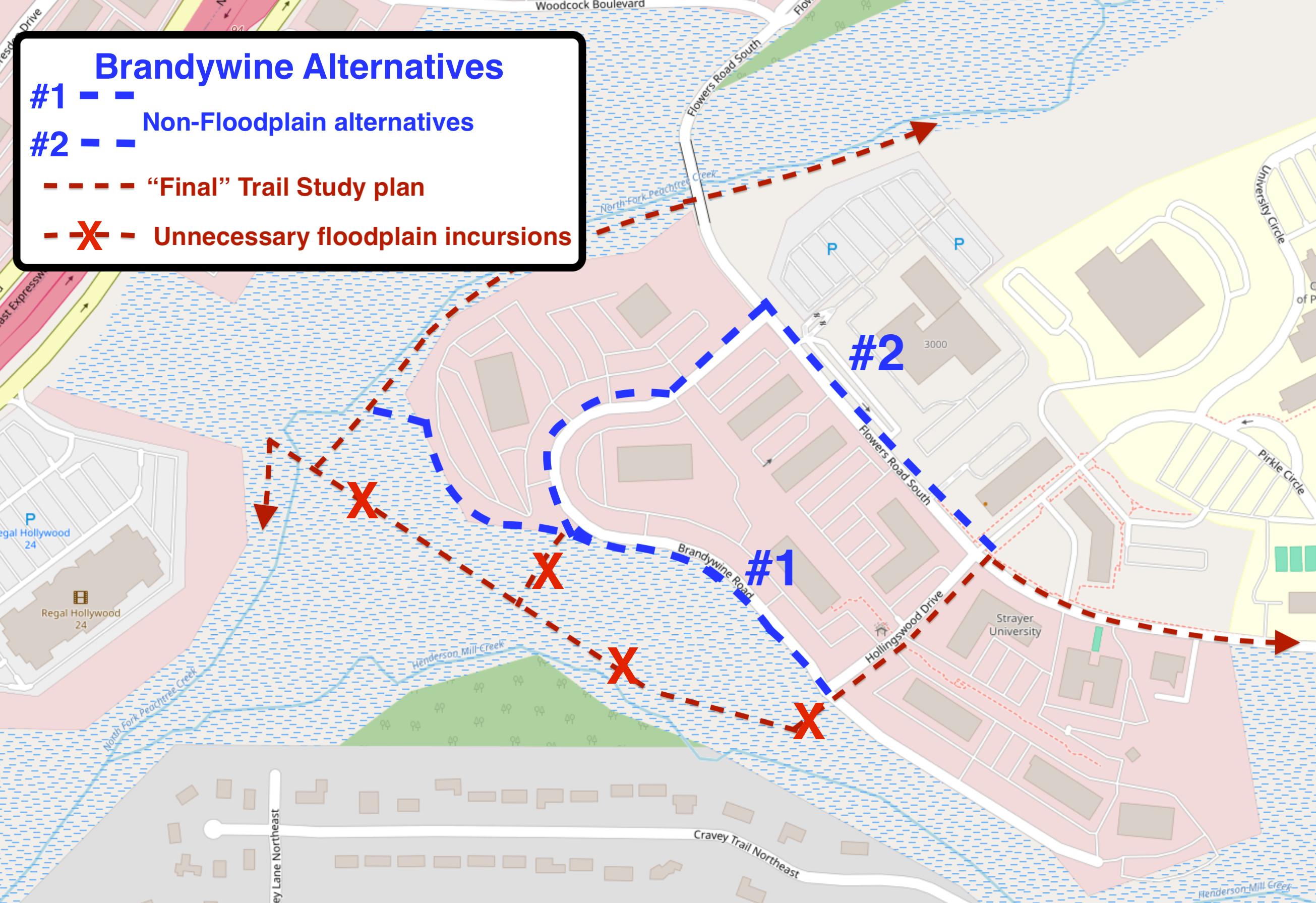
It is completely unnecessary to use this western portion of the HMC floodplain to “complete the Mercer Loop” - there is a very pretty, quiet, safe, short and highly accessible sidepath routing going from Hollinswood to North Fork: See map and the Brandywine Alternative Routing document for specifics.
We still need your help in convincing Dekalb and Mercer to replace this remaining HMC floodplain segment with the FULL Flowers Rd -> Brandywine alternative.
Please Sign Our New Petition !!
The PATH Foundation and Dekalb County are planning to build a concrete bike road through the floodplain/wetlands surrounding Henderson Mill Creek (HMC).
- They call it a “trail” and a “path,” but it is neither. This is a bike road. 12’ wide concrete - wide enough to fit 2 Toyota Corollas side-by-side. A “trail,” as the term is commonly used, is a 2-3’ wide foot path through a forest. PATH’s 12’ concrete route is about 5x wider than a “trail.” What PATH will build is, essentially, a road.
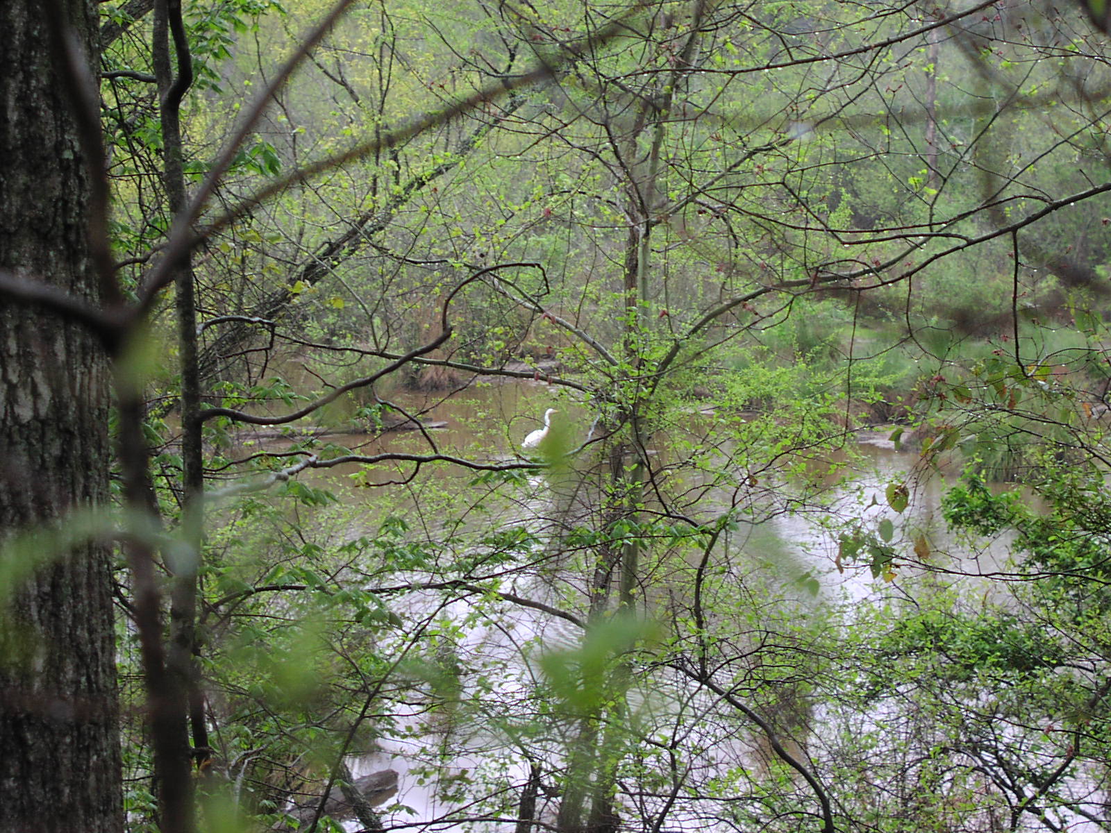
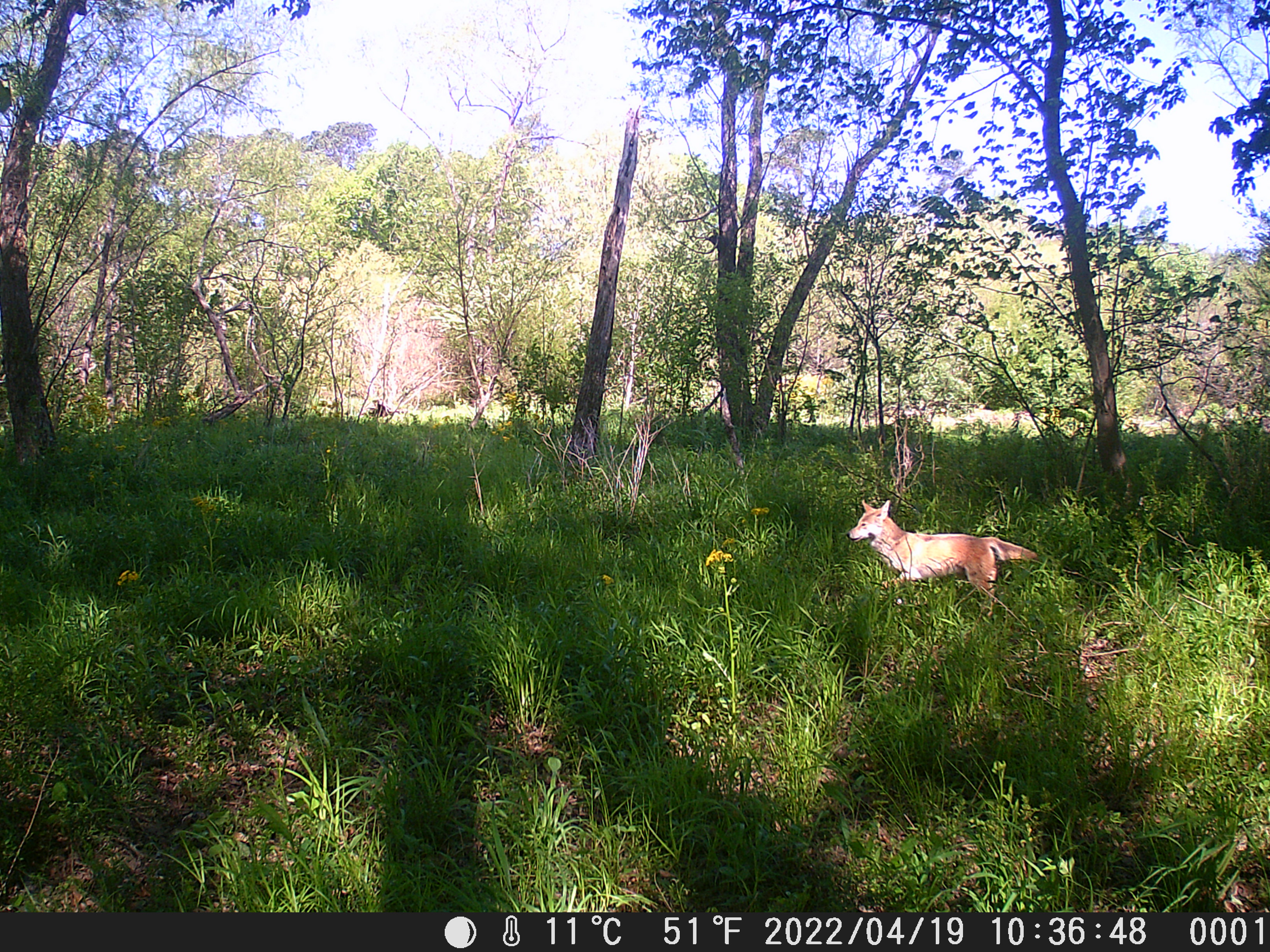
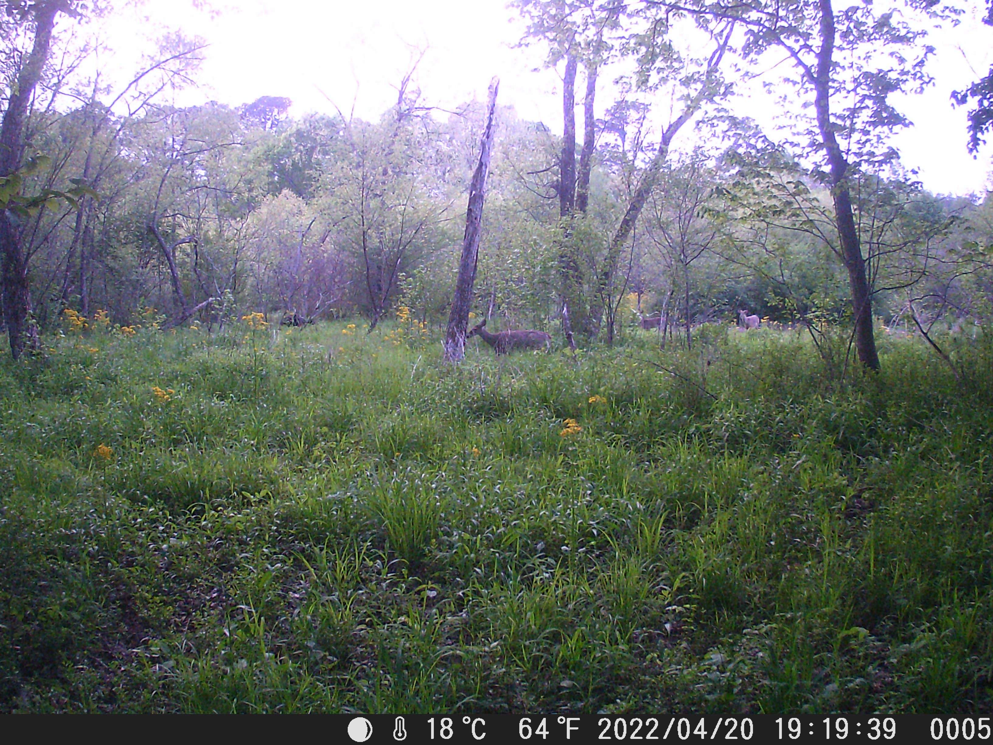
- They say it won’t damage the floodplain, but it will. The floodplain is narrow, narrower than they’ve said. 12’ wide concrete + 2-5’ clearance on either side is large relative to the width of the area. The floodplain is heavily forested, and they will have to take many trees down for a route this wide. The riparian buffer will be breached and wildlife will be driven out. The floodplain will not be the same after this construction.
- They say it’s the only way to connect up Tucker to their planned Peachtree Creek Greenway, but there’s another way. Flowers Road is a perfect location for a safe and pleasant bike path. PATH has publicly stated that they insist on building this bike road through the floodplain “because we can.” The question is not whether you can, the question is whether you should.
- They imply that this concrete road is the only way to “open up” the floodplain for education, exploration, and enjoyment. They couldn’t be more wrong.
There are many reasons to oppose PATH’s plan for the floodplain. We detail them here.
This will significantly damage the beautiful wetlands/flood plain along Henderson Mill Creek.
PATH’s proposed “trail” is actually an elevated, 12ft wide concrete bike road with 2-5ft of natural habitat cleared on both sides. They will use metal piers and metal fenced railings. It will be an eyesore in a beautiful strip of wilderness. Construction will remove trees, clear ground brush/habitat, cause runoff and erosion, and drive out wildlife. This bike road will forever change “a rich, yet imperiled urban forest and riparian environment.” (Mercer’s 2015 HGOR evaluation.)
It should be self-evident that building a concrete bike road through a rich, forested floodplain/wetlands, an “urban jewel,” is a bad thing to do. Frankly, it’s hard to believe we even have to argue about this.
It is invasive to the backing residential neighborhoods.
If the bike road is as highly-used as PATH hopes, it will create noise issues, safety concerns, and destroy privacy of the many homes backing on this area. It will open onto a middle school, creating easy access to the schoolgrounds and, potentially, the schoolkids. It will also open into currently quiet, isolated neighborhoods, creating parking issues and high traffic for homes which were purchased specifically for their quiet and secluded locations.
There are better ways to explore and understand the floodplain.
The PATH proposal builds a raised, railed, 12’ wide concrete thoroughfare end-to-end through the floodplain. This approach keeps users at a distance from the area - there is no way to touch, smell, feel, or even see anything up close. This is an extremely poor way to let the neighborhood truly experience the wonder of the habitat.
The best way to explore and understand this beautiful area is on foot, on the ground, immersed. We have repeatedly pointed out that people can, and do, explore the area on foot as it is. However, we realize this may be a little intimidating for some. A small footpath on the commercial side in the drier areas could provide easier access, while leaving the floodplain undamaged. A true “trail” – 2-3 feet wide, dirt, winding it’s way amongst the trees and scrub and allowing its users to fully engage with the area. This is the best way to experience the floodplain, it’s the least damaging to the habitat, and it might open the way to a more conservationist approach to the area. Win-win-win!
There is an alternative bike route
There already is a perfectly fine biking alternative that is not even being discussed – Flowers Road. This road is directly north of the creek, running parallel, and it goes from Henderson Mill to Mercer. It’s pretty, quiet, wide, and with plenty of room to create a bike path.
When we specifically asked one of the PATH representatives about using Flowers Road instead of the wetlands, we were told that the wetlands “was a done deal.” When another PATH representative was asked, we were told that PATH would use the HMC floodplain “because we can.” This is not a good reason for unnecessarily invading the floodplain.
A bike path using Flowers Road as an alternative to the HMC floodplain should be discussed. PATH refuses to.
PATH is not conducting a study, they are marketing a long-existing plan for HMC.
PATH has a beautiful marketing spiel, and they are using it. PATH has been planning to build through the HMC floodplain since 1999. PATH uses words like “trail” and “path” and “green” to make it sound like this is an ecologically sound plan, but it isn’t. PATH is not considering any alternatives to their plan to pave a bike road through the floodplain, and they should for ecologically fragile riparian environments such as these.
PATH does not present an unbiased view of their proposals. They don’t discuss how much habitat is damaged and even erased, how much wildlife is pushed out, nor how much our neighbors backing on the wetlands are affected. PATH is focused on laying concrete.
Social media claims don’t stand
There have been many discussions in social media (NextDoor) about the PATH bike road plan. Being what it is, minimal detail can be supplied there to explain and rebut the statements. So we explain why the NextDoor claims are wrong here.
Please join us! Together we can save the Henderson Mill Creek from PATH’s concrete bike road.
We want to keep like-minded neighbors informed of developments, upcoming meetings, and how to contact officials in charge. We will keep you updated, and together we can talk and organize! We believe they will stop if they get enough pushback.
We have created a group email list so that we can communicate, plan and act.
